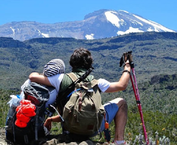
Professionele berggidsen, koks en dragers We bieden goede service en een goede prijs
Het zou niet ongebruikelijk zijn voor klimmers om symptomen van hoogteziekte te hebben terwijl alleen op de tweede dag van de klim vanwege het snelle tempo. Ten tweede zorgt dag vier in combinatie met dag vijf voor een erg moeilijk schema. Dag vier is een volledige trekkingdag van Barranco naar Barafu. Na het diner en een gedeeltelijke nachtrust begint de zeer lange en inspannende topdag rond middernacht. De 6-daagse Lemosho-route vereist 19-24 uur veeleisende wandelingen, op extreem hoge hoogte, met slechts 4-6 uur slaap.
Stijgend (ft): 9.500ft tot 11.500ft
Stuk: 8 km
Wandeltijd: 5-6 uur
Klimatologische habitat: Moorland
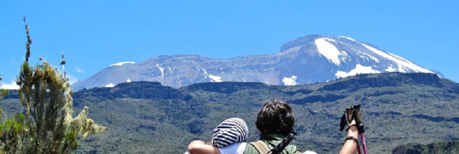
Wandelaar(s) vervolgen het pad dat uit het bos leidt en een savanne in van hoge grassen, heide en vulkanisch gesteente bedekt met korstmosbaarden. Terwijl we stijgen door de weelderige glooiende heuvels en verschillende beekjes oversteken, bereiken we de Shira Ridge voordat we zachtjes afdalen naar Shira 1-kamp. Het uitzicht op Kibo vanaf de overkant van het plateau is fenomenaal, buitengewoon en verbazingwekkend.
Stijgend (ft): 11.500ft tot 13.800 ft
Stuk: 14 km
Wandeltijd: 5-7 uur
Klimatologische habitat: Moorland
Wandelaar(s) en team verkennen een hele dag het Shira-plateau. Het is een rustige wandeling naar het oosten naar Kibo's gletsjertop, over het plateau dat leidt naar het Shira 2-kamp op heideweiden bij een beek. Daarna gaan we verder naar Moir Hut, een weinig gebruikte camping aan de voet van Lent Hills. Een verscheidenheid aan wandelingen is beschikbaar op Lent Hills, waardoor dit een uitstekende kans is om te acclimatiseren. Shira is een van de hoogste plateaus op aarde.
Stijgend (ft): 13.800ft tot 13.000ft
Stuk: 7 km
Wandeltijd: 4-6 uur
Klimatologische habitat: Semi-woestijn
Vanaf het Shira-plateau gaan de wandelaar(s) en het team verder naar het oosten op een bergkam, langs de kruising naar de top van Kibo. Terwijl we verder gaan, verandert onze richting naar het zuidoosten in de richting van de Lava Tower, de "Shark's Tooth" genoemd. Kort na de toren komen we bij de tweede kruising die ons naar de Arrow Glacier brengt op een hoogte van 16.000 voet. We gaan nu verder naar de Barranco Hut op een hoogte van 13.000 voet. Hier rusten we, genieten we van het diner en overnachten we. Hoewel je de dag eindigt op dezelfde hoogte als toen je begon, is deze dag erg belangrijk voor acclimatisatie en zal je lichaam helpen zich voor te bereiden op de dag van de top.
Stijgend (ft): 13.000 ft tot 15.000 ft
Rek: 9 km
Wandeltijd: 8-10 uur
Klimatologische habitat: Alpenwoestijn
Na het ontbijt verlaten de wandelaar(s) en de rest van het team Barranco en gaan verder over een steile bergkam langs de Barranco Wall, naar de camping in Karanga Valley. Daarna verlaten we Karanga en komen bij de kruising die aansluit op de Mweka Trail. We gaan verder naar het Barafu-kamp. Op dit punt heb je het South Circuit voltooid, dat uitzicht biedt op de top vanuit veel verschillende hoeken. Hier maken we kamp, rusten, genieten van het diner en bereiden ons voor op de topdag. Vanuit deze positie zijn de twee prachtige toppen van Kibo en Mawenzi te zien.
Stijgend (ft): 15.300ft tot 19.345ft (en omlaag tot 10.000ft)
Stuk: 5 km stijgen / 12 km dalen
Wandeltijd: 7-8 uur stijgen / 4-6 uur dalen
Klimaathabitat: Arctisch
Heel vroeg in de ochtend (van middernacht tot 02.00 uur) vervolgen Hiker(s) en het team onze weg naar de top tussen de Rebmann- en Ratzel-gletsjers. Wandelaar(s) op de Lemosho-wandelroute gaan in noordwestelijke richting en stijgen door zware puinhellingen naar Stella Point op de kraterrand. Dit is het meest mentaal en fysiek uitdagende deel van de trektocht. Bij Stella Point (18.600 ft) stop je voor een korte rustpauze en wordt je beloond met de meest magnifieke en prachtige zonsopgang die je ooit zult zien (als het weer het toelaat). Vanaf Stella Point kun je de hele weg sneeuw tegenkomen tijdens je klim van 1 uur naar de top. Bij Uhuru Peak heb je het hoogste punt op de Kilimanjaro en het continent Afrika bereikt. Gefeliciteerd!!! Snellere wandelaars zullen de zonsopgang vanaf de top zien. Vanaf de top maken we onze afdaling en gaan we rechtdoor naar de camping Mweka Hut, waar we stoppen bij Barafu voor de lunch. Je hebt beenkappen en trekkingstokken nodig voor het losse grind dat naar beneden gaat. Mweka Camp ligt in het bovenste bos en in de late namiddag kan er mist of regen worden verwacht. Later op de avond genieten we van ons laatste diner op de berg en een welverdiende en bevredigende nachtrust.
Daling (ft): 10.000 ft tot 5.400 ft
Stuk: 10 km
Wandeltijd: 3-4 uur
Klimatologische habitat: regenwoud
Na het ontbijt vervolgen de wandelaar(s) de afdaling naar de Mweka Park Gate om uw topcertificaten te ontvangen. Op lagere hoogten kan het nat en modderig zijn. Slobkousen en trekkingstokken zullen helpen. Shorts en t-shirts zijn waarschijnlijk genoeg om te dragen (houd regenkleding en warmere kleding bij de hand). Vanaf de poort gaan wandelaar(s) nog een uur verder naar Mweka Village. Een voertuig zal de wandelaar(s) ontmoeten in het dorp Mweka om ze terug te brengen naar het hotel in Arusha/Moshi.

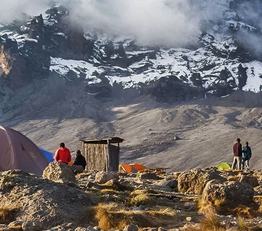
During the climb you will be staying at campsites!
mount kilimanjaro from Nairobi Kenya, mount kilimanjaro from Kampara Uganda, mount kilimanjaro from Kigari Rwanda, kilimanjaro gears, mount kilimanjaro camps, mount kilimanjaro records, mount kilimanjaro clothes, mount kilimanjaro base camp, mount kilimanjaro climbing companies, mount kilimanjaro informations, mount kilimanjaro vegetations and frowers, mount kilimanjaro hiking company, mount kilimanjaro hiking operator, mount kilimanjaro hiking operators, , mount kilimanjaro hiking agency, mount kilimanjaro hiking, mount kilimanjaro internet, mount kilimanjaro electricity, mount kilimanjaro hiking agences, mount kilimanjaro climbing adventures, mount kilimanjaro hiking adventure, mount kilimanjaro hiking holiday, mount kilimanjaro hiking, mount kilimanjaro wanders, mount kilimanjaro to ngorongoro-crater, mount kilimanjaro hiking holidays, mount kilimanjaro hiking expeditions, mount kilimanjaro dangerous, mount kilimanjaro song, mount kilimanjaro ultimate, mount kilimanjaro ten interesting facts about, mount kilimanjaro Tanzania, mount kilimanjaro meaning, mount kilimanjaro the ultimate guide to Africa highest mountain, mount kilimanjaro formation, mount kilimanjaro travel, mount kilimanjaro hiking expedition, mount kilimanjaro climbing organizer, mount kilimanjaro local guide,, mount kilimanjaro acclimatizatiom, mount kilimanjaro creter, mount kilimanjaro national park tourism, mount Kilimanjaro
The Lemosho route is one of the newer routes on Mount Kilimanjaro. The route begins in the west and rather than simply intersecting Shira Plateau (like Machame), Lemosho crosses it from Shira Ridge to Shira Camp. Climbers encounter low traffic until the route joins the Machame route. Afterwards, Lemosho follows the same route through Lava Tower, Barranco and Barafu, known as the southern circuit.
The minimum number of days required for this route is six days, although eight days is ideal.
Lemosho is considered the most beautiful route on Kilimanjaro and grants panoramic vistas on various sides of the mountain.
It is our favorite route because it offers a great balance of low traffic, scenic views and a high summit success rate. Thus, Lemosho comes highly recommended. Most of our clients use Lemosho.
Welcome to Lemosho.com.
If you’re reading this, you’re probably interested in climbing Kilimanjaro on the Lemosho Route. The Lemosho Route is widely considered to be the best route on Mount Kilimanjaro. Not too long ago, there were only two main routes used to climb Kilimanjaro – the Marangu (Coca Cola) route and the Machame (Whiskey) route.
But as Tanzania’s tourism industry flourished, the Kilimanjaro park authority created more trails to African’s highest peak to distribute climbers to more areas of the park. This reduced bottlenecks at certain points and also made for a more pleasant experience by limiting crowds. Additionally, these latter trails were more thoughtfully designed to improve acclimatization for the climber by incorporating longer distances, longer times on the mountain and shorter elevation gains. Lemosho, a relatively new route, falls into this category.
Lemosho is preferred by reputable operators due to its beauty, remoteness and success rate. In short, it maximizes the chances that a climber will reach the summit, and enjoy the experience overall.
The Lemosho route can be done in as little as six days (five nights) on the mountain. However, it is ideally tackled over eight days (seven nights) for a better altitude acclimatization schedule. With eight days (seven nights) on the mountain, your chances of reaching the top are very high, around 90%.
Access to the trail begins with a long drive from Moshi or Arusha to Londorossi Gate. This can take three to four hours. Londorossi Gate is located in the western base of mountain.
Lemosho starts in lush, fertile rainforest. It is the first ecological zone you encounter on Kilimanjaro (we will trek through four). The route heads up and across the Shira Plateau, which used to be Kilimanjaro’s third peak before it collapsed. Then we make our way north to Moir Hut, which serves as a great acclimatization day due to short hikes than can be done in the nearby Lent Hills.
Next, we climb high up and over Lava Tower before dropping into Barranco Valley, one of the prettiest areas on the entire trail. We climb the intimidating Barranco Wall and then circle along the southern circuit to Karanga and high camp Barafu Hut.
The summit attempt is made from Barafu in the early morning hours,often during the full moon. This is the coldest, windiest section of your adventure. But once the sun comes up, so can most of your extra layers. After the summit, the descent follows the Mweka trail.
The Lemosho route is approximately 70 km/ 42 miles from gate to gate. It is designed for physically fit people with some hiking experience. However, we have many clients who tackle the route as their first real backpacking experience. They do very well. The table below depicts a variation of the 8 day Lemosho climb with starting and finishing points, altitude, distance and hiking time. This is considered to be the ideal Lemosho route variation.
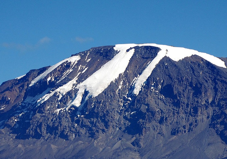
Mount Kilimanjaro is the tallest free standing mountain in the world. People from all over the globe come to Tanzania to climb Kilimanjaro, hoping to stand proudly at Uhuru Point – 19,341 feet high. Crowned in ice, Mount Kilimanjaro is a spectacular sight to behold. But this view will not last long. The glaciers are melting at an alarming rate due to global warming and will be completely gone in 50 years.
In 2013, an estimated 50,000 tourists climbed Mount Kilimanjaro. The number has been steadily growing every year. What makes Kilimanjaro such a magnetic draw for adventurous folks is that climbing Kilimanjaro does not require technical skills or mountaineering equipment such as ice axes, crampons, harnesses and ropes. Kilimanjaro is entirely a walk up mountain. As long as you can put one foot in front of the other, and are in decent fitness, you can climb Mount Kilimanjaro.
Mount Kilimanjaro is regulated by the Tanzania National Park Authority. The authority maintains the six major routes on Mount Kilimanjaro to ensure safety, cleanliness and flow.
Also, park rangers monitor the activity on the moutain to check that every climber is accompanied by a licensed guide. Tourists are not allowed to climb Kilimanjaro on their own.
Anyone who climbs Kilimanjaro should be outfitted properly. This is important because Kilimanjaro creates its own weather. It is possible to encounter a blizzard, torrential rains, or brutal windsduring any season. You don’t conquer a mountain. She allows your passage, if she is feeling nice. People who are not adequately prepared pay the price very quickly.
Tanzania does not have four seasons like most people are accustomed to. Instead, Tanzania experiences wet and dry seasons. During the wet season, rain can fall steadily everyday, making your time on the mountain pretty difficult. Therefore, the best time to climb Kilimanjaro is during the dry season. Those months include: January, February, July, August, September, October. The rainy season months are: March, April, May, June, November and December.
The Lemosho route is considered the most scenic trail on Kilimanjaro, granting panoramic vistas on various sides of the mountain. As one of the newer routes, Lemosho is a superb choice for your climb. It is our preferred route due to its ideal balance of low crowds, beautiful scenery and a high summit success rate. Ultimate Kilimanjaro® specializes in guiding on the Lemosho route. Most of our clients climb Kilimanjaro using this route and they consistently report that they loved it. Thus, Lemosho is highly recommended.
The route approaches Mount Kilimanjaro from the west, beginning with a long drive from Moshi to Londorossi Gate. From there, the first two days are spent trekking through the rain forest to Shira Ridge. The Lemosho route crosses the entire Shira Plateau from west to east in a pleasant,relatively flat hike. Crowds are low until the route joins the Machame route near Lava Tower. Then the route traverses underneath Kilimanjaro's Southern Ice Field on a path known as the Southern Circuit before summiting from Barafu. Descent is made via the Mweka route.
The Leomosho route avoids the crowds on the early part of the Machame route and over 8 days, you have a fantastic journey and a great chance of summiting successfully.
The climb begins at Londorossi Gate, at an altitude of 2360 metres, with an approach far to the west of the mountain. It passes through majestic rainforest where some of the region’s most unique wildlife can often be seen. The route continues up to the mountain’s third summit at Shira Ridge. From there you will cross the famed Shira plateau and see the awe inspiring Shira Cathedral before reaching Shira camp on the main Machame route on day three. This allows a few days of quiet climbing overlooking some amazing terrain before taking the more heavily travelled route to the summit. After reaching the summit, you will descend by the Mweka trail, rather than retracing your steps along the ascent route.
The Lemosho route is a good eight day hike for those who have not trekked much at high altitudes, with an effective extra day’s acclimatisation, giving a better success rate. Experienced and already acclimatised mountaineers may opt for the more difficult 7 day ascent along the Lemosho route.
The Lemosho Route is relatively new. It starts on the Western side of Mount Kilimanjaro at the Londorossi Gate and was introduced as an alternative to the Shira Route which begins at a higher, more challenging altitude.
The Londorossi Gate is a fair drive from the town of Moshi, and considerably further from Arusha. At the gate you will register with the authorities before being driven a further 12km to the starting point.
The western side of Kilimanjaro is still very wild and you may get lucky and spot large antelope, buffalo and maybe even elephant.
The Lemosho Route joins the Machame Route at Lava Tower and heads down towards Barranco Valley via the Southern Circuit (see map below). As with the Machame Route, Lemosho trekkers need to transverse the Barranco Wall and then summit from Barafu Camp.
Most trekkers complete the Lemosho Route in eight days; however some tour operators offer seven day treks and six day hikes (not recommended) on the Lemosho. The 8-day variation is great for acclimatisation and of course increases the probability of success. The seven day route typically stops for a night at both Shira Camp 1 and Shira Camp 2. Eight day treks stop again at Karanga Camp for another acclimatization day.
Take the challenging and less-travelled Lemosho route, considered by many to be the most beautiful path up the western breach of the mountain, to the Shira Plateau. This adventure starts off with a few long days as you gain altitude, and has several days built in to help you acclimatize, improving your chances of making the summit. Enjoy the climb through magnificent forests and moorland, and emerge into high-alpine deserts as you enjoy spectacular views along the way to the summit.
The Lemosho route is one of the newest Kilimanjaro routes. It was introduced as an alternative to the Shira route, which starts at a higher and therefore more challenging altitude. In light of its versatility, gorgeous scenery and rather untouched, wild start to the climb, the Lemosho is considered the route with the most variety. This route can be completed in seven or eight days
we love the Lemosho route. It’s our personal favourite because you get to experience a bit of everything. We really enjoy the first couple of days in the forest, and also the opportunities to take beautiful photographs of the amazing views and scenery along the way. In fact, the Lemosho route stops over at locations that offer some of the best sunrises and sunsets on Kilimanjaro.
All of this beauty goes hand in hand with the fact that the chances of summiting Kilimanjaro are high among trekkers using the Lemosho route – always a plus!
The Lemosho route therefore ticks all of the boxes when it comes to choosing a Kilimanjaro climb. If you’re especially concerned about acclimatising, you can also opt for an eight-day Lemosho route over the seven-day option, as this gives you even more time to acclimatise.
The Lemosho route is known for being one of the most beautiful Kilimanjaro routes. You walk through lush rainforest on the first couple of days. Spotting large wildlife, like antelopes, is not very common but possible! The route also gives you the experience of hiking across the Shira Plateau, which is one of the largest high-altitude plateaus in the world. The plateau affords you fantastic views of the dramatic rock buttress known as Shira Cathedral.
No Kilimanjaro climb is easy, but the Lemosho route is generally considered one of the ‘easier’ climbs because of it’s great acclimatisation profile. It has great ‘climb high, sleep low’ opportunities. Put simply, with the right Kilimanjaro preparation anyone can climb this route. You should be physically fit, and with the right support in the form of your mountain crew, you can achieve the summit whether you have previous hiking experience or are a first-time trekker.
The Lemosho route has one of the best summit success rates of all the routes up Kilimanjaro. This is because the path more than once takes you high before dropping you back down to sleep low. Proper acclimatisation is the name of the game on this route! Whilst there are no official statistics, the average success rate across all Kilimanjaro operators is 90% for the eight-day Lemosho trek and 85% for the seven-day Lemosho trek. Follow Alice has a success rate of over 95% for both the seven- and eight-day Lemosho routes!
The Lemosho route can be completed in seven or eight days. The extra day gives you more time to acclimatise.
The Lemosho route is generally less busy than other Kilimanjaro routes such as the Machame route. This is especially the case on the first couple of days when you’re passing through the forest. You then join the Machame route near the Lava Tower. This is when the crowds can get a little bigger in peak season.
The Lemosho route only offers camping accommodation. As part of the Follow Alice climbing package, all of your camping equipment is included: tent, sleeping bag, sleeping mat and pillow. And during the trek all tents are pitched and then taken down by our mountain crew.
Follow Alice offers the Lemosho route as a seven-day group climb or private climb. Our seven-day Lemosho package costs $2,585 per person (based on double occupancy). This includes seven days on the mountain and one day either side at our beautiful partner lodge in Moshi. If you’d like to know more about how we arrived at this price and what’s included, please read How much does it cost to climb Kilimanjaro? If you decided to go for the eight-day Lemosho Route, the cost increases to $2,895 per person (also based on double occupancy). This option includes eight days on the mountain and one day either side at our partner lodge in Moshi. For more information on package inclusions and exclusion, as well as more details about the trip, head to our Kilimanjaro climb
The Lemosho route can be done in seven or eight days. The extra day on the eight-day route allows for an extra day of acclimatisation, which is always a good thing. Have a look at the two itineraries below before deciding which option suits you.
The trek starts at Lemosho Gate on the western slope of Kilimanjaro. You climb to the summit, then descend the mountain via the Mweka route, which has you exit the park at Mweka Gate on the southern slope.
The Lemosho route approaches the mountain from the west. Before the climbing can begin, you must drive to the Londorossi Gate of Kilimanjaro National Park. If you’ve been staying in Moshi, as we do, the drive takes four hours. You spend the first couple of days trekking through the rainforest to Shira Ridge. You then join the Machame route near the Lava Tower. The route then follows a path known as the Southern Circuit, which traverses underneath Kilimanjaro’s Southern Ice Field. You then summit from Barafu, and descend via the descent-only Mweka route.
If you want to add a little adventure onto the end of your Kilimanjaro climb, we recommend going on a Tanzania safari – you won’t find a better African safari! Or hop over the border into Uganda to trek with mountain gorillas. Alternatively, if you’ve limited time and budget, why not do one or two extra activities in the Kilimanjaro region like visit a Maasai village or a coffee farm?
Now that you’ve made the decision to climb the highest peak in Africa, it’s time to prepare. We know that planning a Kilimanjaro packing list can seem a daunting task, so we’ve made it as easy as possible for you by putting together an extensive packing guide that you can follow! If you pack everything in our list, you can rest assured you’ll be fine on your Kilimanjaro trek. For those who are more visual and would prefer to watch a video, have a look at our packing list video a little further down.
Climbing Kilimanjaro is like hiking from the Equator to the North Pole in a matter of days, as you start the trek walking in a hot and humid rainforest and quickly ascend to a world of ice and glaciers. This means you need to pack hiking gear for all weather! We’ve put together a comprehensive Kilimanjaro packing list to help you with your Kilimanjaro preparation. The list is divided into the following categories:
The trail begins north of Shira, also on the western side of the mountain. But unlike the Shira Route, where for the first day you walk on a wide 4 WD road, Lemosho is a narrow wilderness trail right from the beginning, passing through pristine and remote rainforest with good chances of seeing wildlife. It then crosses the Shira Plateau before joining the Machame Route near the Lava Tower. Luckily, despite its growing popularity (especially with second time Kilimanjaro climbers), Lemosho sees a very low number of people. It's all relative. There is still a massive gap between Marangu Route and the theMachame Route, the two really crowded routes, and all the others. There is an obvious reason why the numbers on Lemosho will always remain much lower than on Marangu or Machame: it's not the cheapest option.
Lemosho is also a fairly demanding route, due to both the nature of the terrain and the duration of the trail. On the plus side Lemosho offers the best chances of any route to acclimatize to the altitude and with that much better summit chances. The fact that you are likely to climb this route with a quality Kilimanjaro tour operator also means your success chances are much better than average. And if your operator has developed your itinerary in a way that avoids the big traffic surges on the Machame trail (some operators do) you will have a great climb all the way, on the most scenic route, without the crowds that plague the popular trails.
There are several possible variations to the Kilimanjaro Lemosho route, so don't be surprised if you see an intinerary that mentions different camps and different heights.
The itinerary below describes a seven night/eight day Kilimanjaro climb on the Lemosho Route.
Like Machame this trek can be shortened if you skip the night in the Karanga Valley and instead walk straight from the Barranco Huts to the Barafu Huts in one day.
Some operators also skip the second night at Shira One, making it a VERY strenuous six day trek.
The trek can be extended by adding an extra night at Moir Huts
for acclimatisation.For experienced mountaineers there is also a challenging and dangerous specialist version via the Western Breach.
(Note: altitudes and distances are approximations. Different sources will give you different numbers.)
Starting Point: Londorossi Gate (2100 m/6900 ft)
The starting point for the Lemosho Route is the Londorossi Gate. It is a two to three hour drive to get there and on this first day you may well spend more time driving and waiting around at the gate than you will be walking.
Londorossi (name for the village and the park gate) looks like something pulled out of a cheap Western. The place is entirely made out of wood. The high timber fences you see are supposed to keep the wildlife out.That already indicates the advantage of taking this less trafficked route. You do indeed have a better chance to see some wildlife on the first days.In fact, you very well may right then and there: a troop of the beautiful black and white Colobus monkeys have taken up residence in the trees right next to the park ranger quarters. Check them out while you are waiting for the registration and permits to be organised - the usual start of a Kilimanjaro climb!
After the registration at the gate you have to return the way you came, about ten minutes through some fields and cypress plantations, to get to the trail head. Some call it Londorossi, some Lemosho Glades, some Simba.
Another gate, another fee—paid to the forest authority for maintainig the road.
You follow the muddy road for another 20 minutes until you finally get to the real trail head.
Your trek begins in dense, misty rainforest. The forest is beautiful, like out of a fairy tale. It is full of smaller wildlife, colobus and darkgreen monkeys being the most conspicuous. In the early days, shortly after the route was established, you had to be accompanied by an armed ranger here because of the water buffaloes. The much larger number of climbers these days means bigger animals are are rarely seen.
This very first day on the Lemosho Route has several steep sections to get the pump pumping, but it only takes two to three hours to reach your fist campsite, the Big Tree Camp or Mti Mkubwa.
(The official name is Forest Camp but nobody calls it that.)
It's a lovely camp, located, as the name says, under a big tree and with plenty of monkeys and birds around. Even if you don't see them, you should hear them in the evenings and mornings.
The second day may be "only" four to five hours worth of walking, but it won't be a short day. The trail is very steep today and you will take many breaks.
Once you reach the first major ridge, you leave the forest behind and enter the moorland with its giant heathers as you work your way up towards the Shira Plateau.
There are a couple more steep ridges, offering great views, a well deserved break, and a descent in the valley on the other side.
Eventually, some time after lunch, the path flattens out. (Did I mention the path is steep?) Before you know it you are standing on the edge of the Shira Plateau at 3612 m (11840 ft): Kibo is straight ahead of you, the Shira Ridge to your right and you are overlooking the plateau below.
Yes, below. It's all downhill from here. Your next camp, Shira I, is at 3480 m (11420 ft).
There are many different possibilities on day three, many variations to the route. The more common version takes you directly across the plateau. The walk leads steadily uphill but is nowhere near as steep as yesterday.
After one to one and a half hours you reach the junction of the Lemosho Route and the four wheel drive track that is the beginning of the Shira Route. This is the location of the Simba Cave Campsite (3590 m/11780 ft) on the side of the Simba River.
Another hour to hour and a half, and you reach your most likely final destination, the Shira Huts camps.
People trekking with a higher end operator may instead take the turn off half way between the route junction and the Shira Huts, and spend the night at the quieter Fischer Campsite(3885 m/12745 ft), which is some way off the main trail.
Some companies may even use Fischer as a lunch stop only and continue to Moir Huts (4140 m/13579 ft).
There is also the option to stay at Shira Huts and make the detour to Moir Huts tomorrow.
This was the more common straight route. There is another, much more interesting and longer option for day 3: a detour to the southern edge of the rim and the Shira Cathedral, including a climb to its summit (3720 m/12200 ft).
Yes, it makes for a much longer day, but it is a very scenic and varied walk, with great views all the way, and don't forget the benefits of the additional acclimatisation you get by climbing to the top of the Cathedral.
Find an operator who takes the detour. It's worth itAssuming you camped at Shira Huts, the fourth day starts with a good two and half hours of walking mostly gently uphill (and scrambling a bit for two short sections). Following the slope of the Lemosho Plateau you gradually leave the heather and moorland behind and enter the mostly barren alpine desert region, enjoying breathtaking views all the way.
Soon you come across the first junction. One option is to add an acclimatization day here and continue your trek to Moir Huts (4140 m/13579 ft), thirty minutes off the main trail. This is a scenic and quiet campsite in a valley surrounded by steep slopes, possibly the quietest camp on the mountain. If your operator takes you here you will arrive around lunch time and spend the afternoon exploring the Lent Hills, including an acclimatization walk to 4700 m.
The other climbers continue on the main trail. After some bends and ups and downs you reach the junction with the busy Machame Route. Shortly after you come to another junction. You have the options to either head towards the Lava Tower as a detour or even for another extra night, or to continue straight on towards Barranco.
(Climbers tackling the summit via the difficult and dangerous Western Breach route will turn off towards the Lava Tower Camp.)
The Lava Tower is a 100 m/300 ft volcanic plug, left over from times when Kilimanjaro was volcanic. The path towards it is a gentle slope and as you climb towards it even the short heather disappears altogether to reveal the rocky ground of the lava ridges.
The climb is often experienced as strenuous. After all, you'll be climbing up to over 4500 m and your body will sure notice the the lack of oxygen!
After a much deserved lunch break near the Lava Tower you descend into the beautiful Barranco Valley, the result of a massive landslide some 100,000 years ago. The valley is sheltered by towering cliffs and is much greener. There is vegetation again, most notably the giant senecios and lobelias. You have great views across the plains way below and you also get your first glimpse of the Barranco Wall. You will climb that tomorrow...
The Barranco Camp is without a doubt the most spectacular campsite of this route, with fantastic views of Kibo, the Western Breach and the first of the southern glaciers, a fitting reward after a strenuous day.
Don't be surprised if you have slight symptoms of altitude sickness. You have been quite high today, but by climbing high and sleeping low you are giving your body the best chances to adapt. Don't be disheartened about the loss of hard earned altitude. This was an important day for acclimatisation.
Whether climbers reached the Barranco Camp via Machame, Shira, Lemosho, or even on a special route around the northern circuit, from this point onwards all climbers follow the same trail...
Climbing Mount Kilimanjaro?
This Guide Will Get You To The Summit!
Super fit athletes in their 20s or 30s regularly fail to climb Kilimanjaro. Elderly folks in their 70s and even 80s regularly make it to the summit. There is a reason for that.
The overall success rate on what is supposed to be the easiest route is said to be 42%. Some trekking operators have client success rates between 80% and 90%. There are good reasons for that, too.
And that is what this guide is all about. Keep reading, because...
I will show you how you can approach your Kilimanjaro climb with a summit success chance of 90% and more.
I'm not kidding and I'm not promising too much, either.
All in our group made it to the crater rim. One woman did not continue because she had never planned to do so. She did not show any signs of being affected by the altitude, and I am sure if she had wanted to, she could have made it to the summit.
One younger guy had to turn around because he was getting way too cold and weak. He had been struggling with the altitude for the last couple of days already.
There were nine people in our group, the other seven made it to the summit. The operator had a second group on the same route at the same time. They all made it to the summit. That is 13 people out of 15, or 86.7%.
An 86.7% success rate and none of the other climbers were particularly well prepared at all. Route selection, climb duration, time of the year and last but not least the climb operator are all huge factors by themselves.
Add good preparation, and over 90% is not a stretch at all.
It's a done deal.
Oh, and one more thing. When our group met for the very first time, for our briefing and to meet our guides, and after we had all introduced ourselves and told a bit about how we had prepared, there were two people in our group who the head guide said he can pretty much guarantee will summit. My mother an I.
How To Climb Kilimanjaro
On this page you can get a good overview of what it takes to climb Mount Kilimanjaro. Every issue that I mention here is explained in detail on another page, often several pages, but this is the place to start!
Weather at Kilimanjaro - When to climb
The weather on Mt. Kilimanjaro affects your climb and your success chances. Read about what to expect at different times of the year.
Mt. Kilimanjaro Climbing Routes
There are seven routes and they vary in length and difficulty. Read about their advantages and disadvantages.
Mount Kilimanjaro Tours
One of the most important decisions you have to make is to pick a tour operator or trekking agency. This page tells you what to look out for.
The Cost Of Climbing
Climbing Kili is expensive. This page tells you where the money goes, and why it's money well spent.
Training For A Kilimanjaro Climb
What training do you need? And when should that training start? What should you do? And how much of it?
Altitude Sickness
It is not the lack of fitness that prevents people from reaching the summit, it's altitude sickness!
Free Guide
A printable version of the Mount Kilimanjaro Guide is coming...